


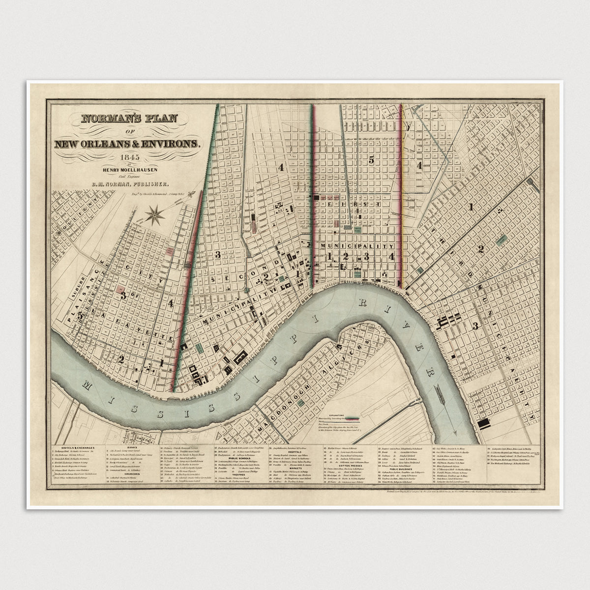

Archival print reproduction of an antique map of New Orleans, Louisiana from 1845 by Henry Moellhausen.
- Medium: Archival pigment inkjet print
- Paper: 100% cotton, museum-quality, acid-free, heavyweight, matte finish
- Size: 11x14 or 16x20 inches (includes a 1/8 inch white border)
All prints come unframed.
About This Map
Shows divisions of municipalities. Contains index of hotels and exchanges, banks, churches, schools, theaters, hospitals, markets, cotton presses and public buildings.
Title: Norman's Plan of New Orleans and Environs
Author: Henry Moellhausen (1825-1905)
Year: 1845