


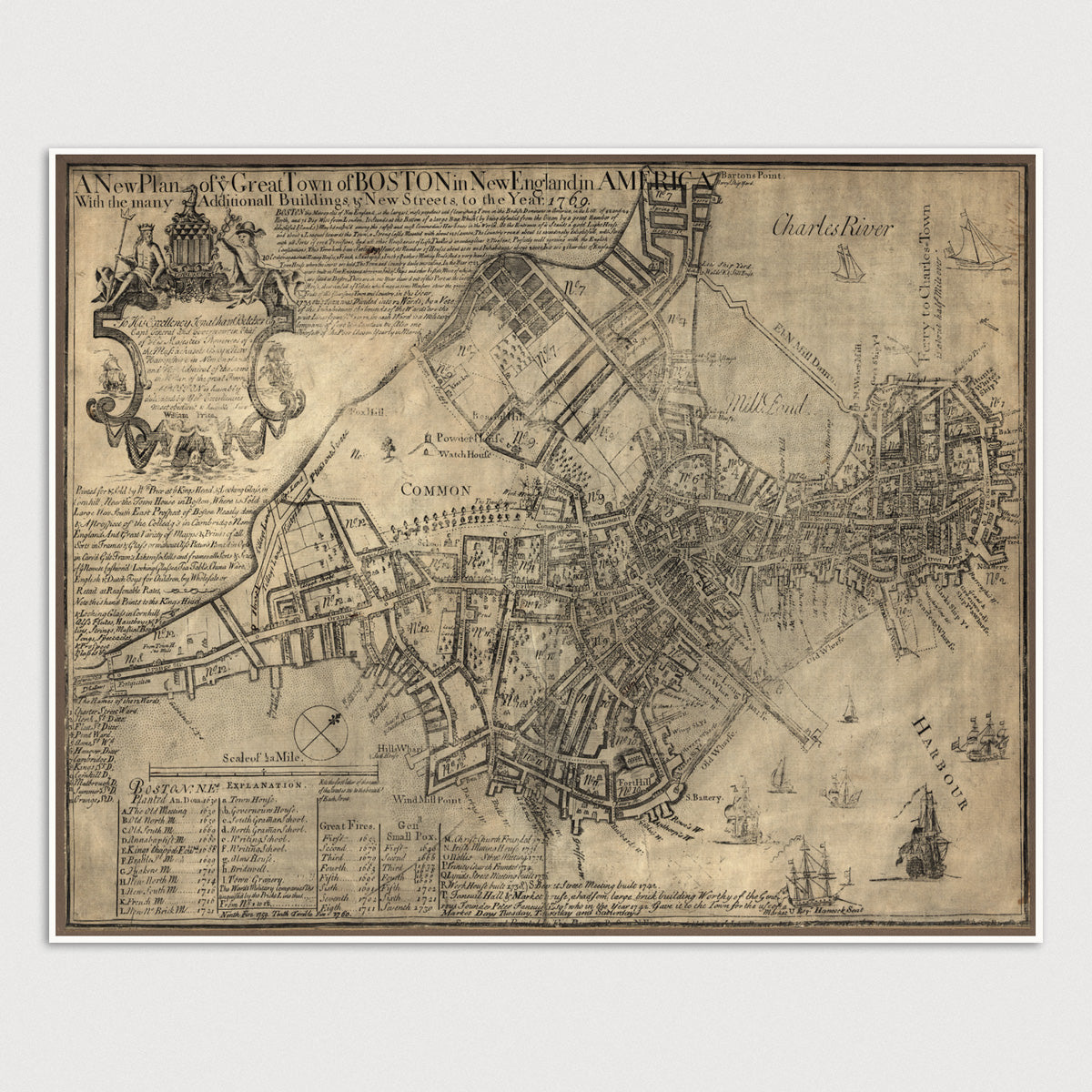
Archival print reproduction of an antique map of Boston, Massachusetts from 1769 by William Price.
- Medium: Archival pigment inkjet print
- Paper: 100% cotton, museum-quality, acid-free, heavyweight, matte finish
- Size: 11x14 or 16x20 inches (includes a 1/8 inch white border)
All prints come unframed.
About This Map
Printed on the eve of the Revolutionary War by William Price, this map of Boston was dedicated to Jonathan Belcher (governor of Massachusetts and New Hampshire) and contains a wealth of information about the city in the late 18th century. The map includes an index indicating the locations of numerous meetings houses, schools, markets and churches, as well as the dates of fires and outbreaks of smallpox between 1649 and 1760.
Text at the top of the map describes the city in glowing terms: "Boston the metropolis of New England, is the largest, most populous and flourishing Town in the British Dominions in America... It stands at the Bottom of a large Bay, Which (by being defended from the Ocean by a great number of delightful Islands) May be reckoned among the safest and most Commodious Harbours in the World...," etc.
The map also includes a bit of advertising for William Price's shop, with a list of goods sold, including "Mapps and Prints of all Sorts in Frames and Glass," seashells, looking glasses, tea tables, Chinaware, English and Dutch toys, and musical instruments.
Title: A New Plan of Ye Great Town of Boston in New England in America with the Many Additionall Buildings and New Streets, to the Year, 1769
Author: William Price (fl. 1725-1769)
Year: 1769