


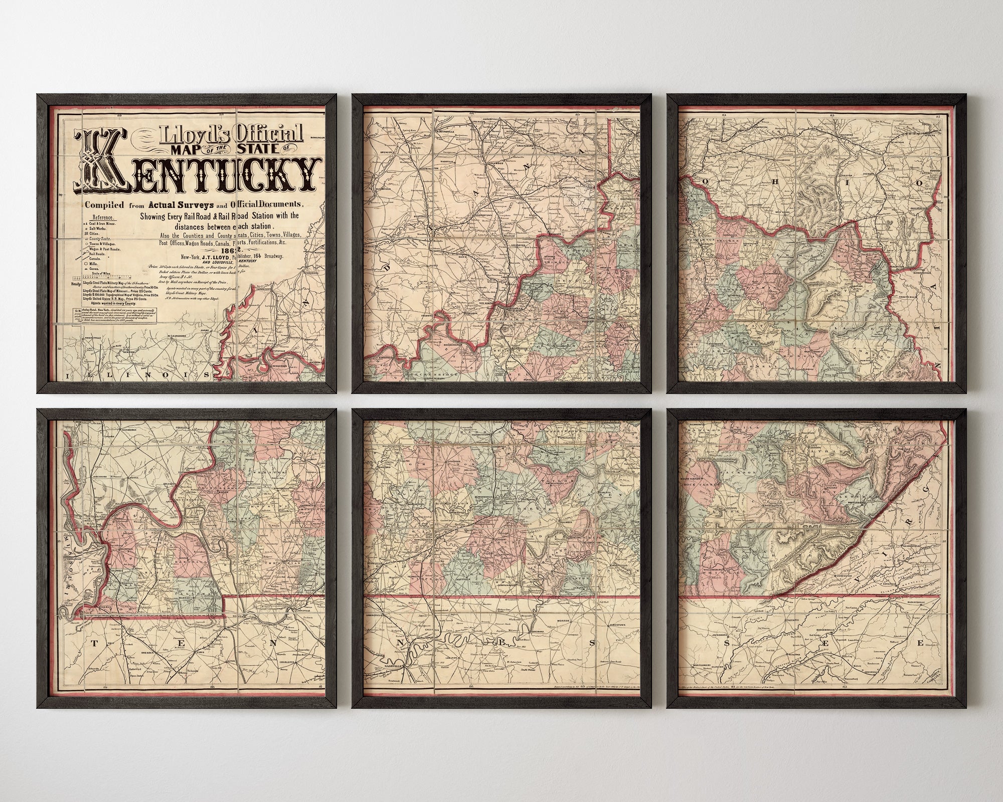
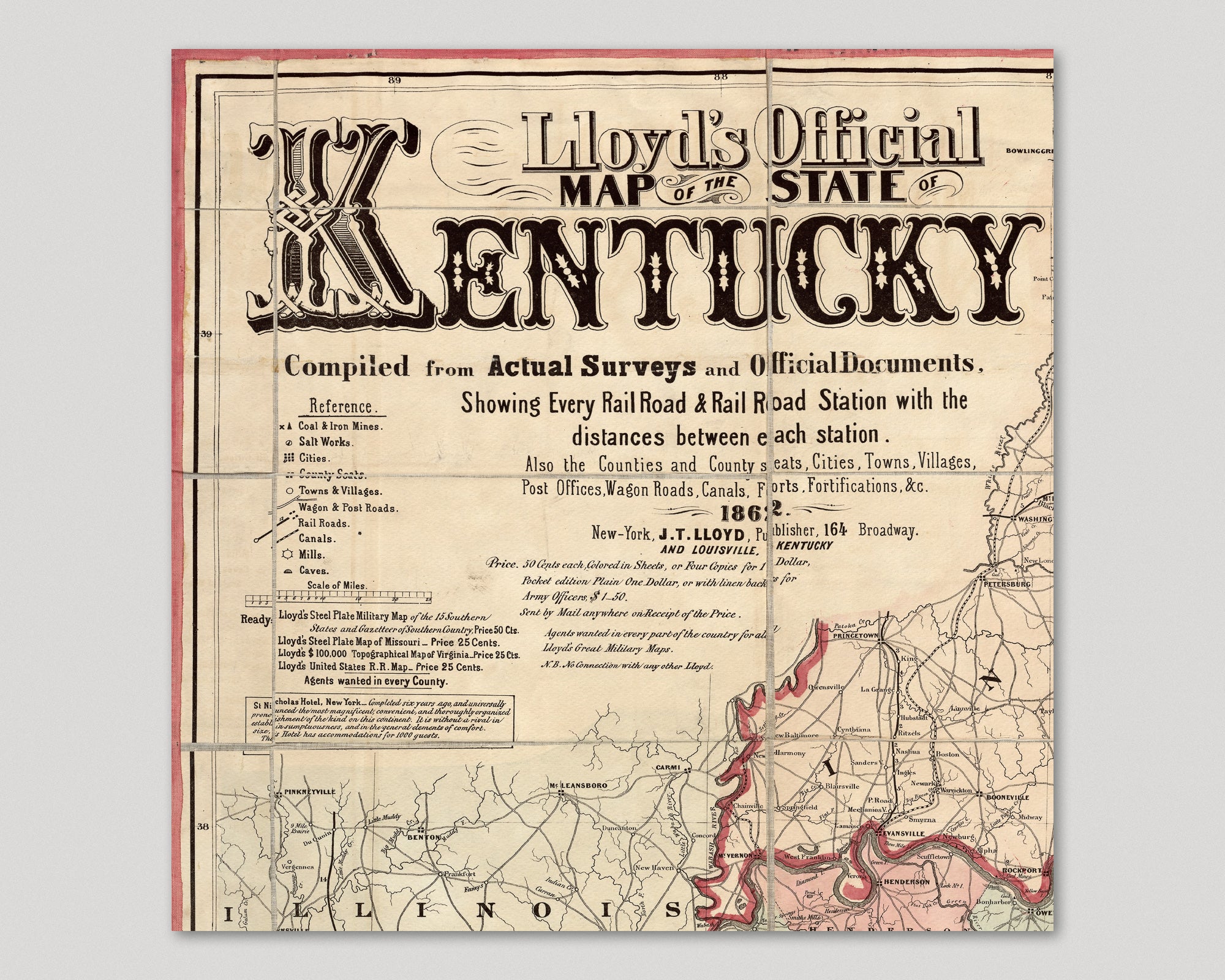
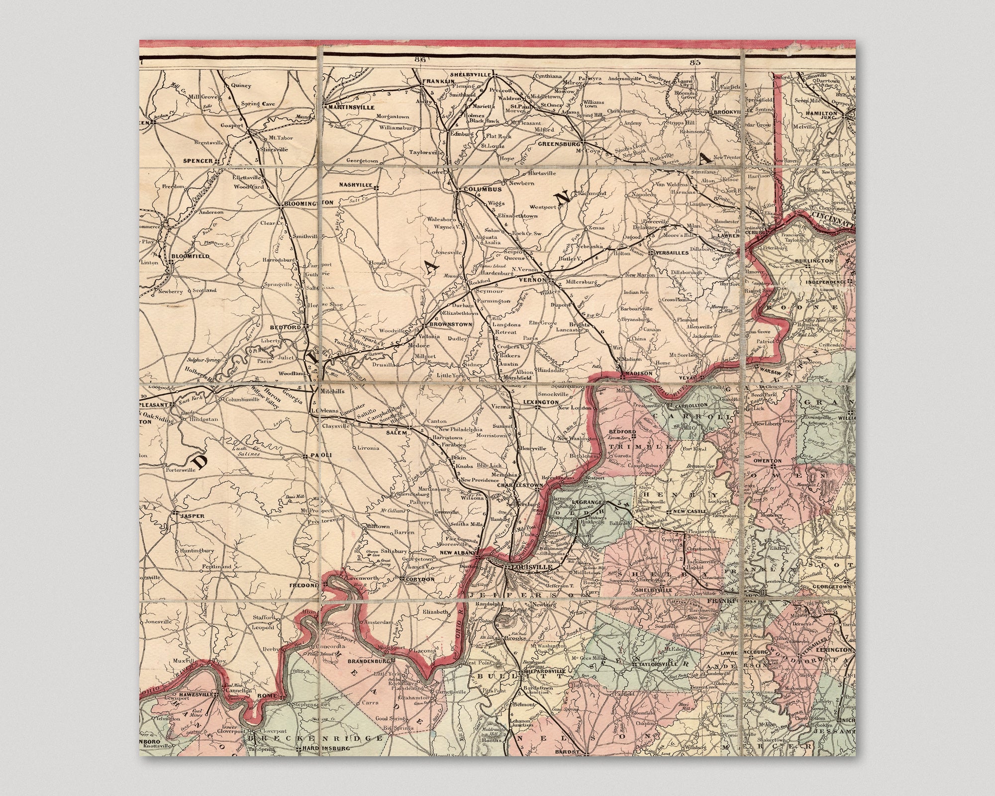
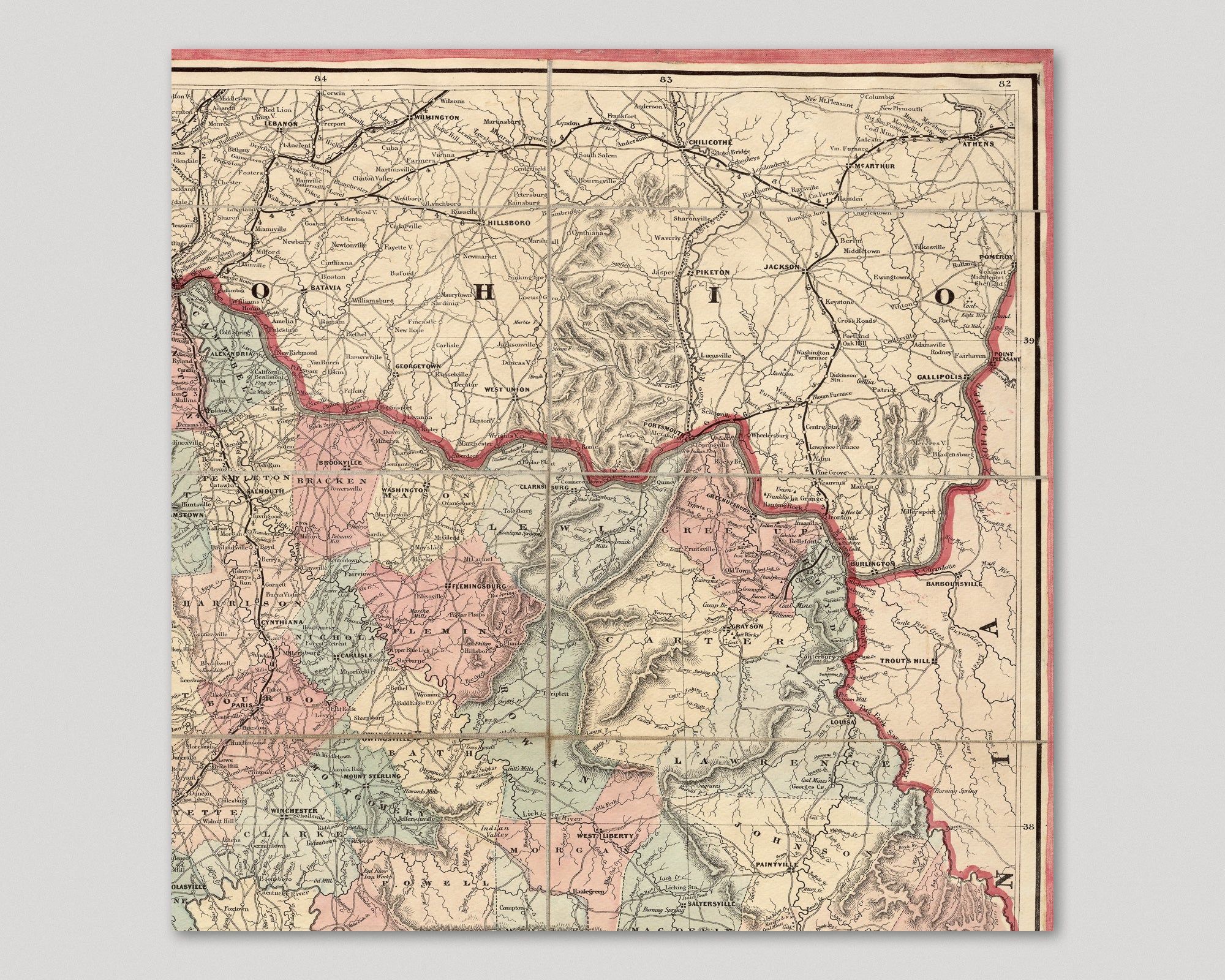
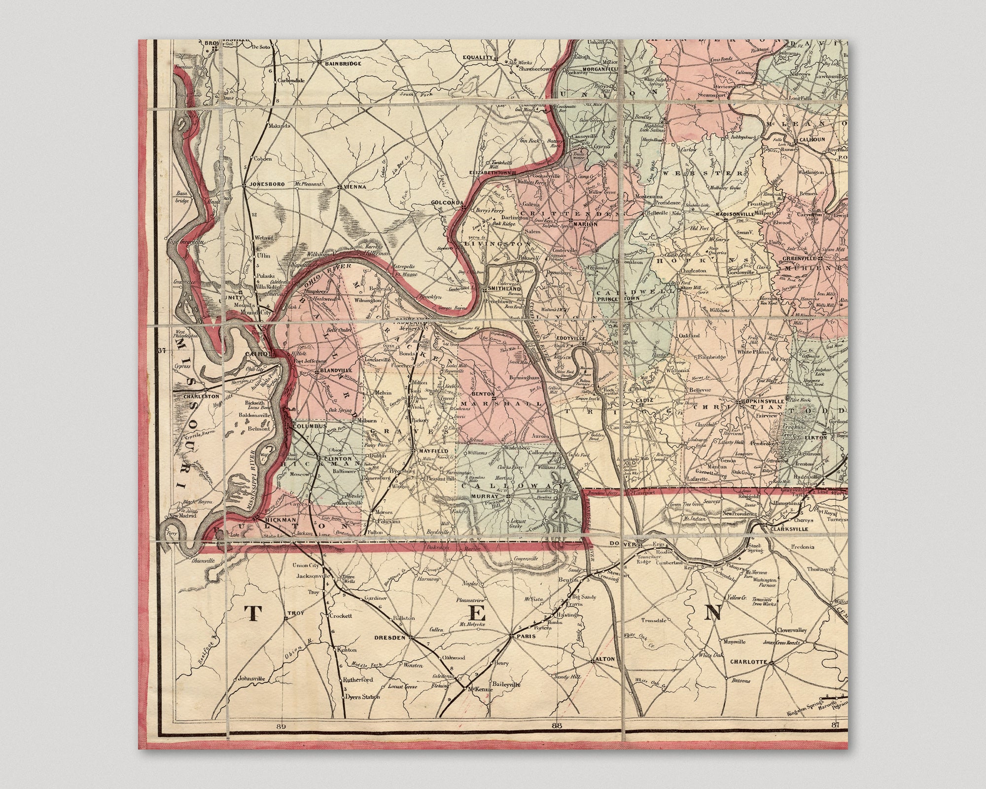
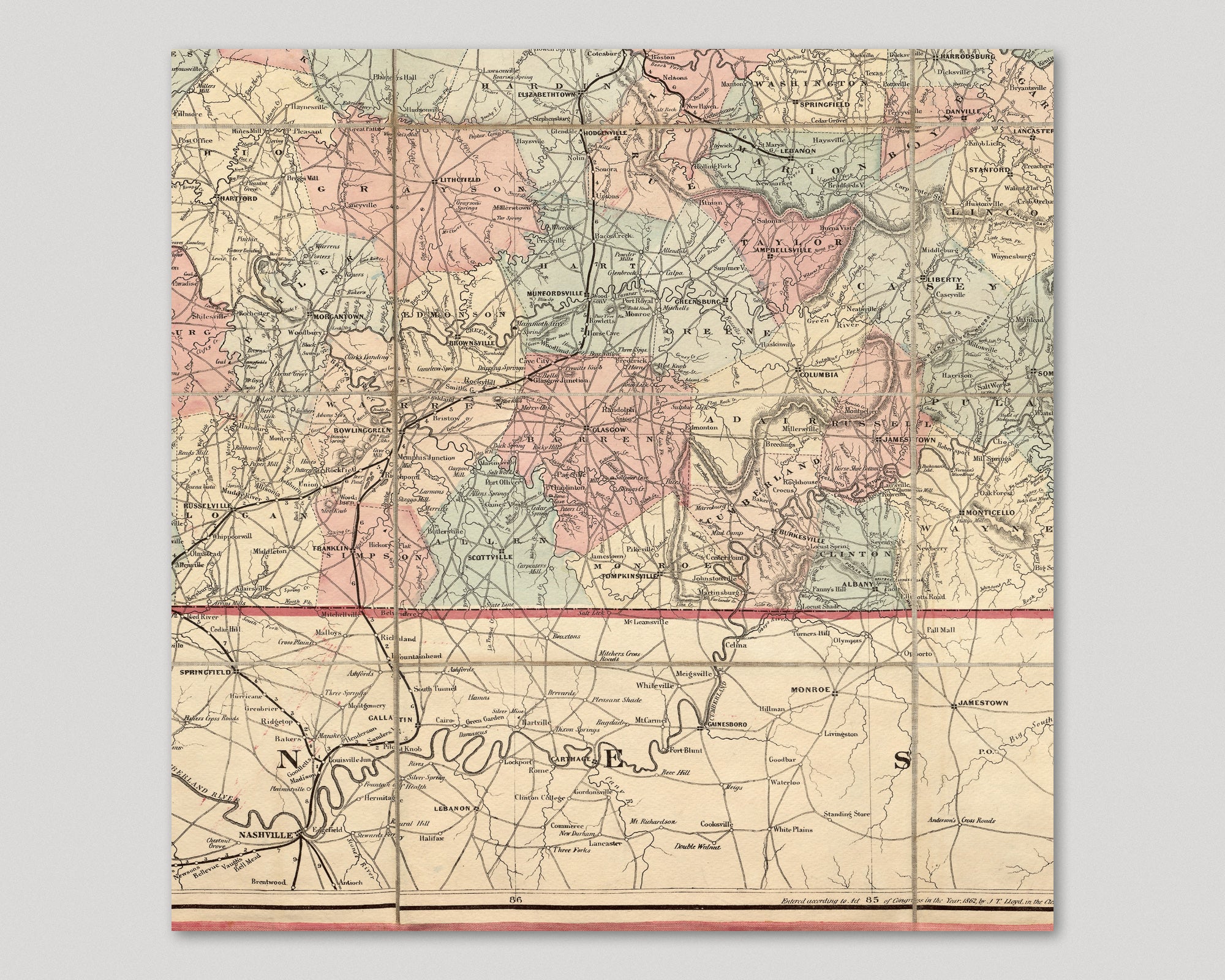
Archival print reproduction of an antique map of Kentucky from 1862 by James T. Lloyd.
- Medium: Archival pigment inkjet print
- Paper: 100% cotton, museum-quality, acid-free, heavyweight, matte finish
- Size: 12x12 or 16x16 inches per print
Sold as a set of 6 individual prints. Each print is sized to fit perfectly in a 12x12 or 16x16 inch frame without a mat.
All prints come unframed.
About This Map
Detailed 19th century map of Kentucky, showing the locations of counties, cities, towns, rivers, roads, railroads, mountains, and mines.
Title: Lloyd's Official Map of the State of Kentucky Compiled From Actual Surveys and Official Documents, Showing Every Rail Road and Rail Road Station With the Distances Between Each Station
Author: James T. Lloyd
Year: 1862