


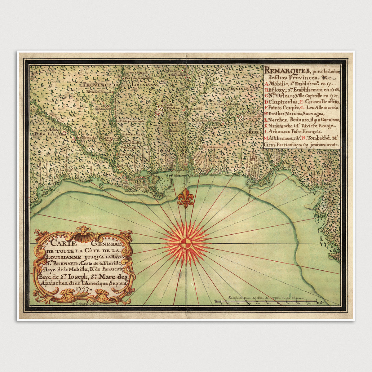
Archival print reproduction of an antique map of the US Gulf Coast from 1747 by Alexandre de Batz.
- Medium: Archival pigment inkjet print
- Paper: 100% cotton, museum-quality, acid-free, heavyweight, matte finish
- Size: 11x14 or 16x20 inches (includes a 1/8 inch white border)
All prints come unframed.
About This Map
Shows the Gulf Coast from Galveston Bay in Texas to Tampa Bay in Florida. Includes numerous place names in French and Spanish, as well as the locations of villages, forts, and Native American tribes.
Title: Carte General de Toute la Côte de la Louisianne Jusqu'a la Baye St. Bernard, Coste de la Floride, Baye de la Mobille, Be. de Pansacole, Baye de St. Ioseph, St. Marc des Apalaches. dans l'Amerique Septentle. (General Map of the Coast of Louisiana to St. Bernard Bay, Coast of Florida, Mobile Bay, Pensacola Bay, St. Joseph Bay, St. Marc des Apalaches in North America)
Author: Alexandre de Batz
Year: 1747
Language: French