


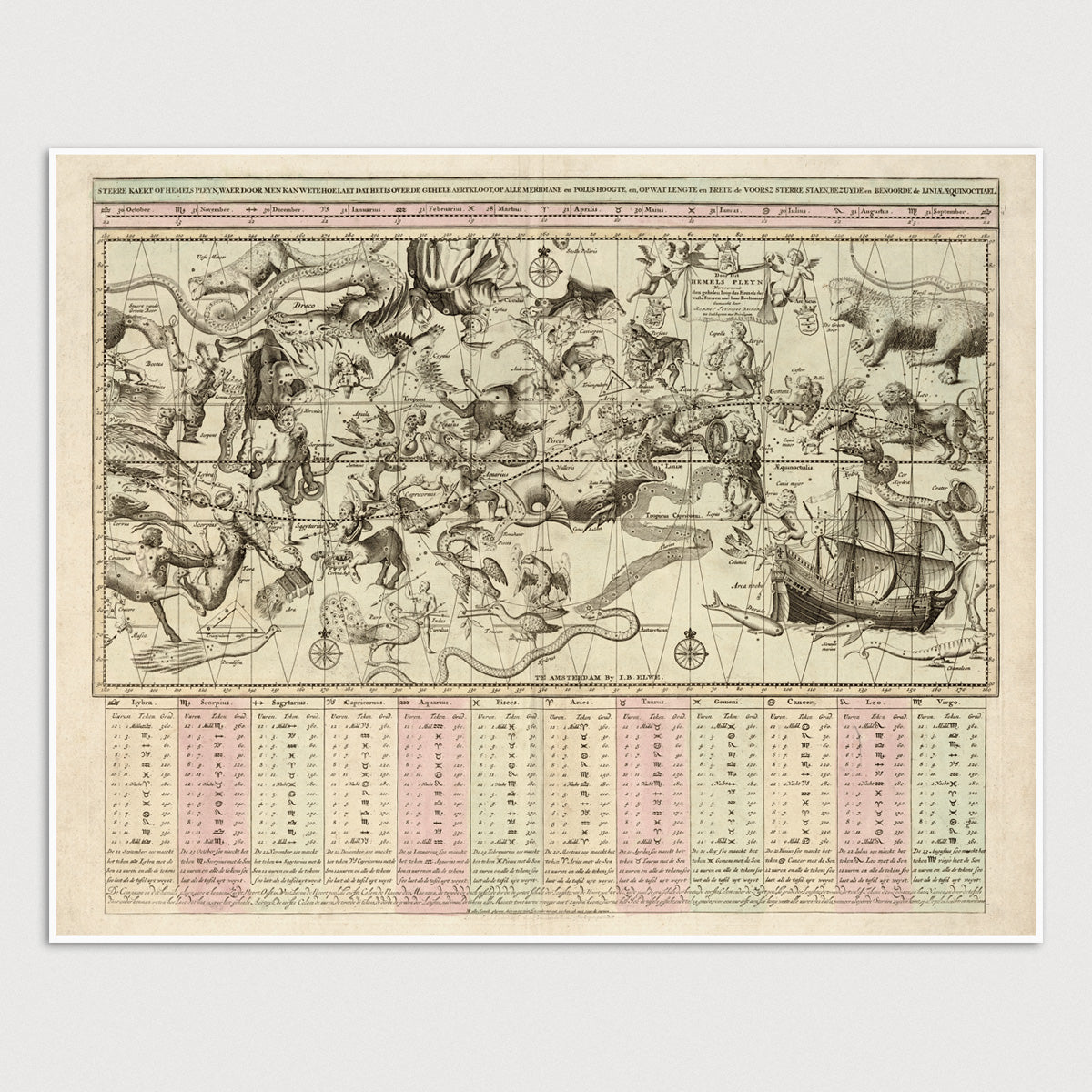
Archival print reproduction of an antique constellation map from 1792 by Jan Barend Elwe.
- Medium: Archival pigment inkjet print
- Paper: 100% cotton, museum-quality, acid-free, heavyweight, matte finish
- Size: 16x20 inches (includes a 1/8 inch white border)
All prints come unframed.
About This Map
Star chart that shows constellations of both northern and southern hemispheres from the equinoctial to both poles. This map is unusual in that it shows the constellations as if looking down on the Earth as opposed to looking out, so the constellations are reversed. Charts at the bottom show measurements grouped by zodiacal sign.
Title: Sterre Kaert of Hemels Pleyn, Waer Door Met Kan Wete Hoe Laet Dat Het Is Over De Gehele Aertkloot Op Alle Meridiane En Polus Hoogte, En Op Wat Lengte En Brete, De Voorsz Sterre Staen, Bezuyde en Benoorde de Liniae Aequinoctiael
Author: Jan Barend Elwe
Year: 1792
Language: Dutch