


Chicago Antique Map Print Set (1863)
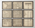
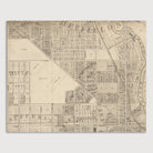
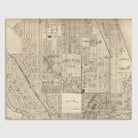
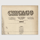
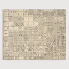
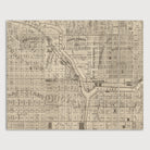
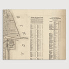
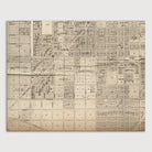
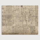
Archival print reproduction of an antique map of Chicago, Illinois from 1863 by Charles Shober. Covers central Chicago, from about 15th St. in the south to about Armitage Ave. in the north, and from the lake west to Western Ave.
Product Details
Medium: Archival pigment inkjet print
Paper: 100% cotton, museum-quality, acid-free, heavyweight, matte finish
Size: 9 prints at 8x10, 11x14 or 16x20 inches per print
Sold as a set of 9 individual prints. Each print is sized to fit perfectly in a 8x10, 11x14 or 16x20 inch frame without a mat.
All prints come unframed.
Production Times & Shipping
We process and print all orders within 1–2 business days. Ground shipping is free within the US; ground shipping time is 1–5 business days. Shipping upgrades are also available. Read more about shipping.