


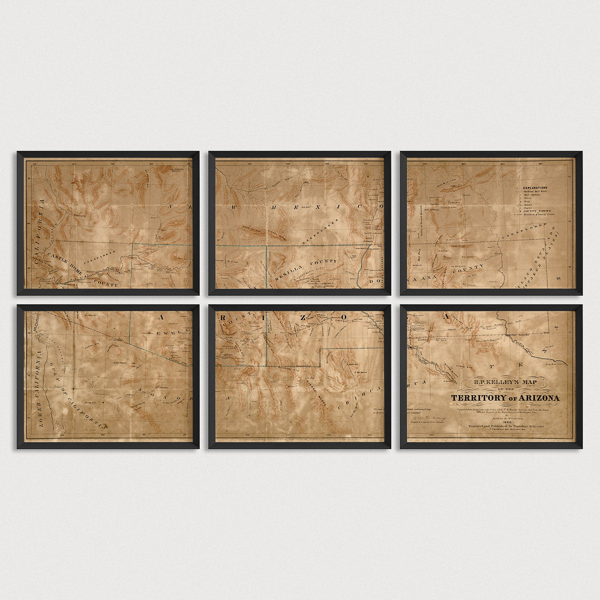

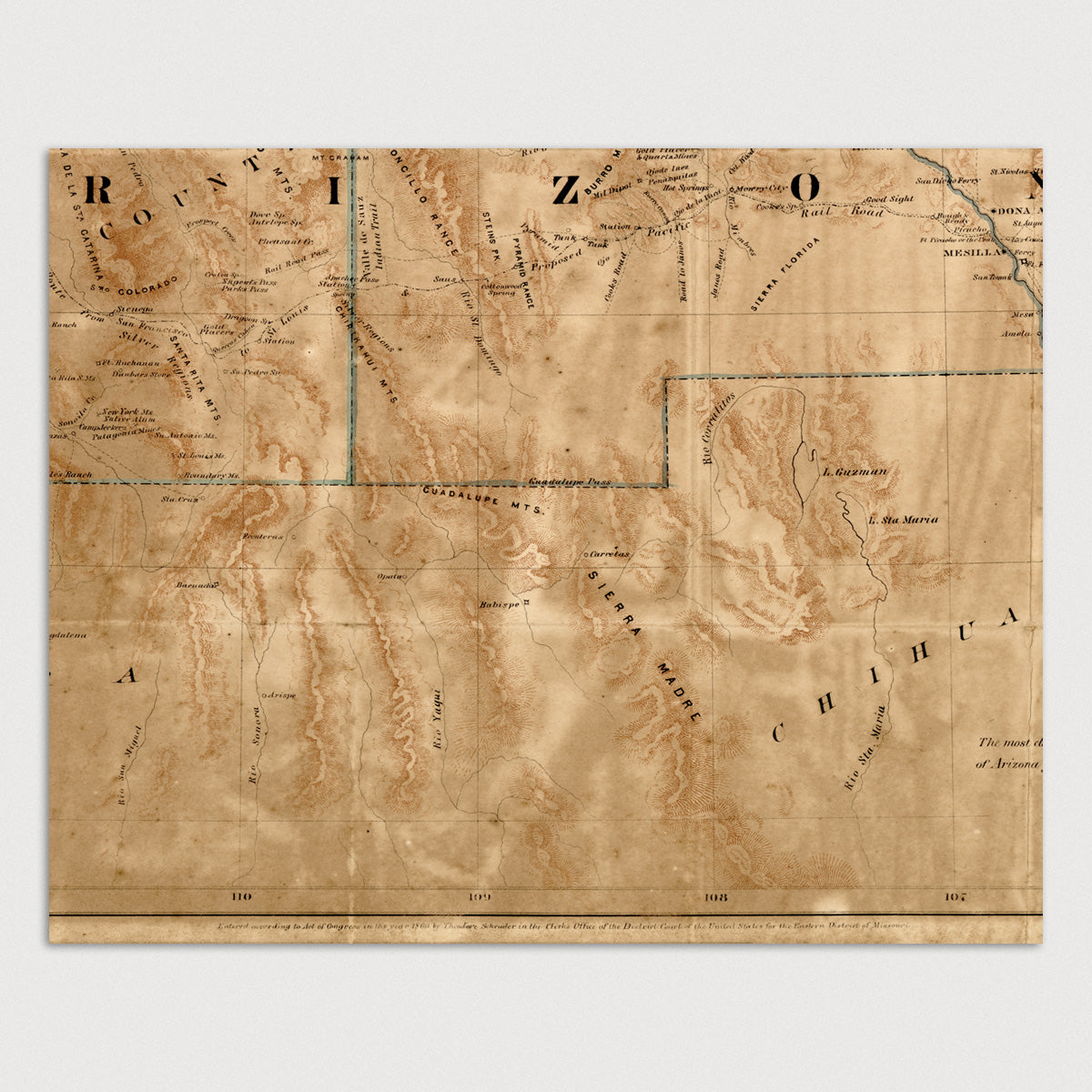
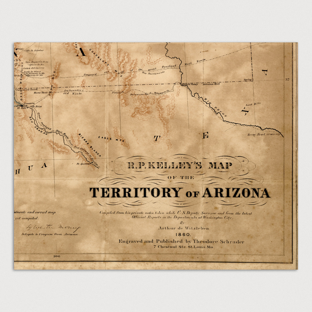
Archival print reproduction of an antique map of Arizona and New Mexico from 1860 by Arthur de Witzleben.
- Medium: Archival pigment inkjet print
- Paper: 100% cotton, museum-quality, acid-free, heavyweight, matte finish
- Size: 8x10, 11x14 or 16x20 inches per print
Sold as a set of 6 individual prints. Each print is sized to fit perfectly in a 8x10, 11x14 or 16x20 inch frame without a mat.
All prints come unframed.
About This Map
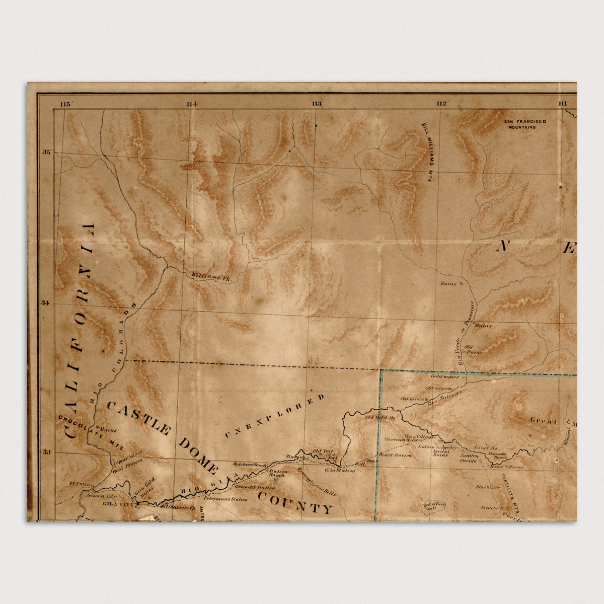
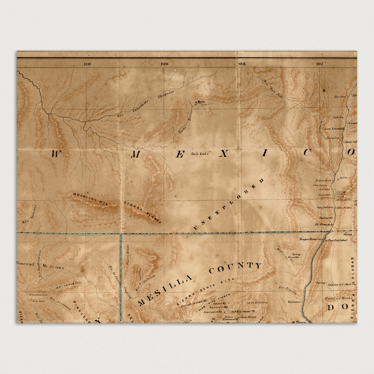
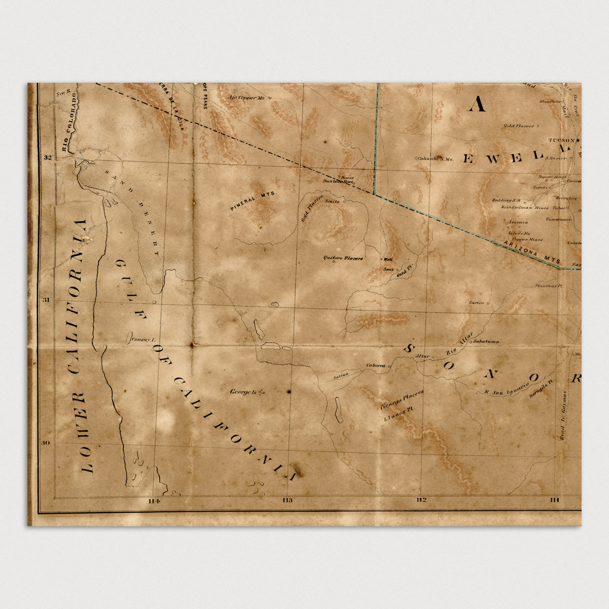
Created before Arizona officially became a territory of the United States, this map of Arizona and New Mexico shows proposed boundaries of a new Arizona Territory with a dividing line between it and New Mexico running east-west as opposed to the current north-south line. Arizona is shown as completely to the south of New Mexico. The map covers most of present day Arizona and New Mexico, showing the area from the Colorado River and border with California in the west to Texas in the east, and from the southern border with Mexico to Albuquerque and the San Francisco Mountains near present-day Flagstaff in the north.
The map shows numerous details, including towns, forts, mines, ruins, mountains, rivers, mail stations, and the track of the Overland Mail Route. Several areas of the map are simply marked as "Unexplored".
Title: R.P. Kelley's Map of the Territory of Arizona
Author: Arthur de Witzleben
Year: 1860