


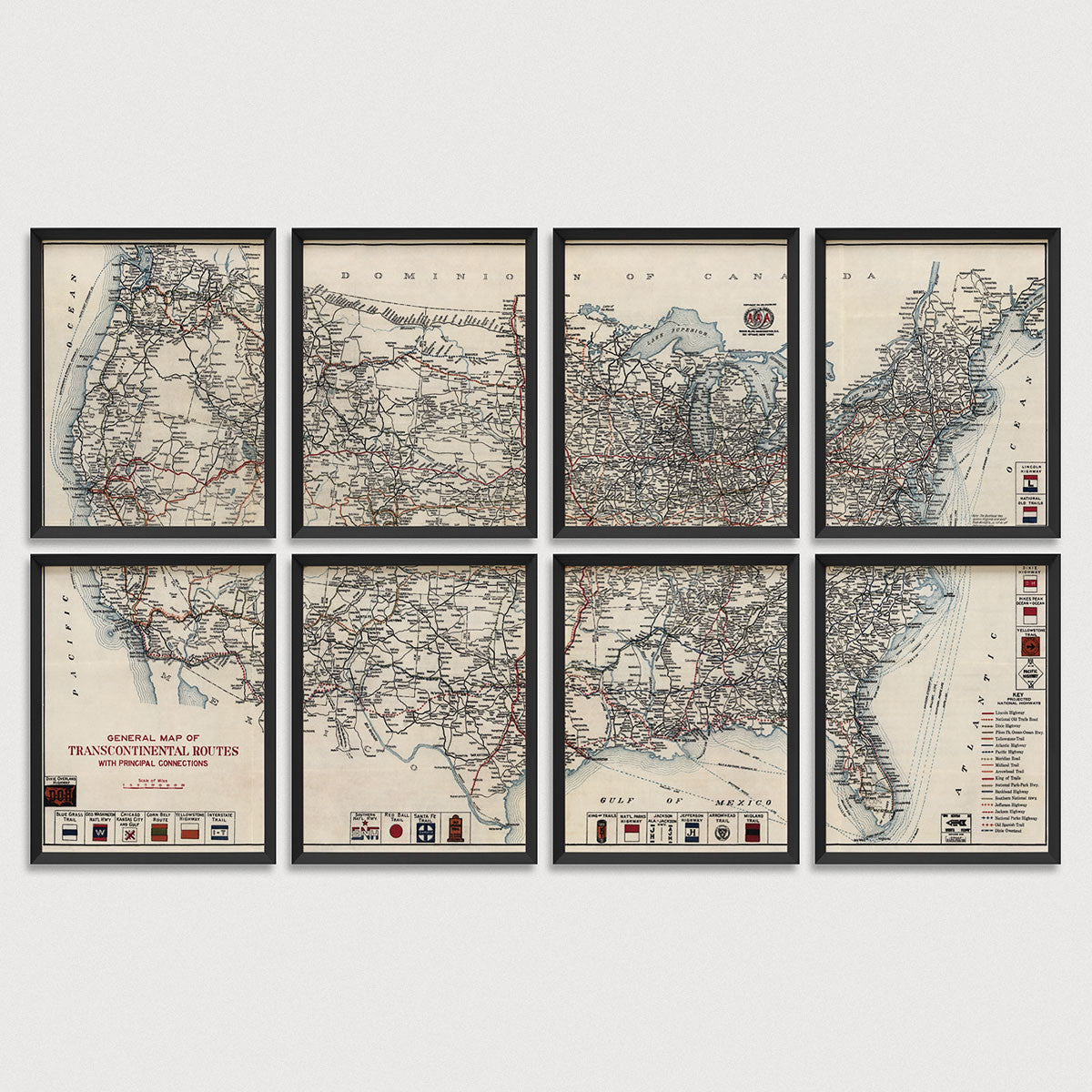
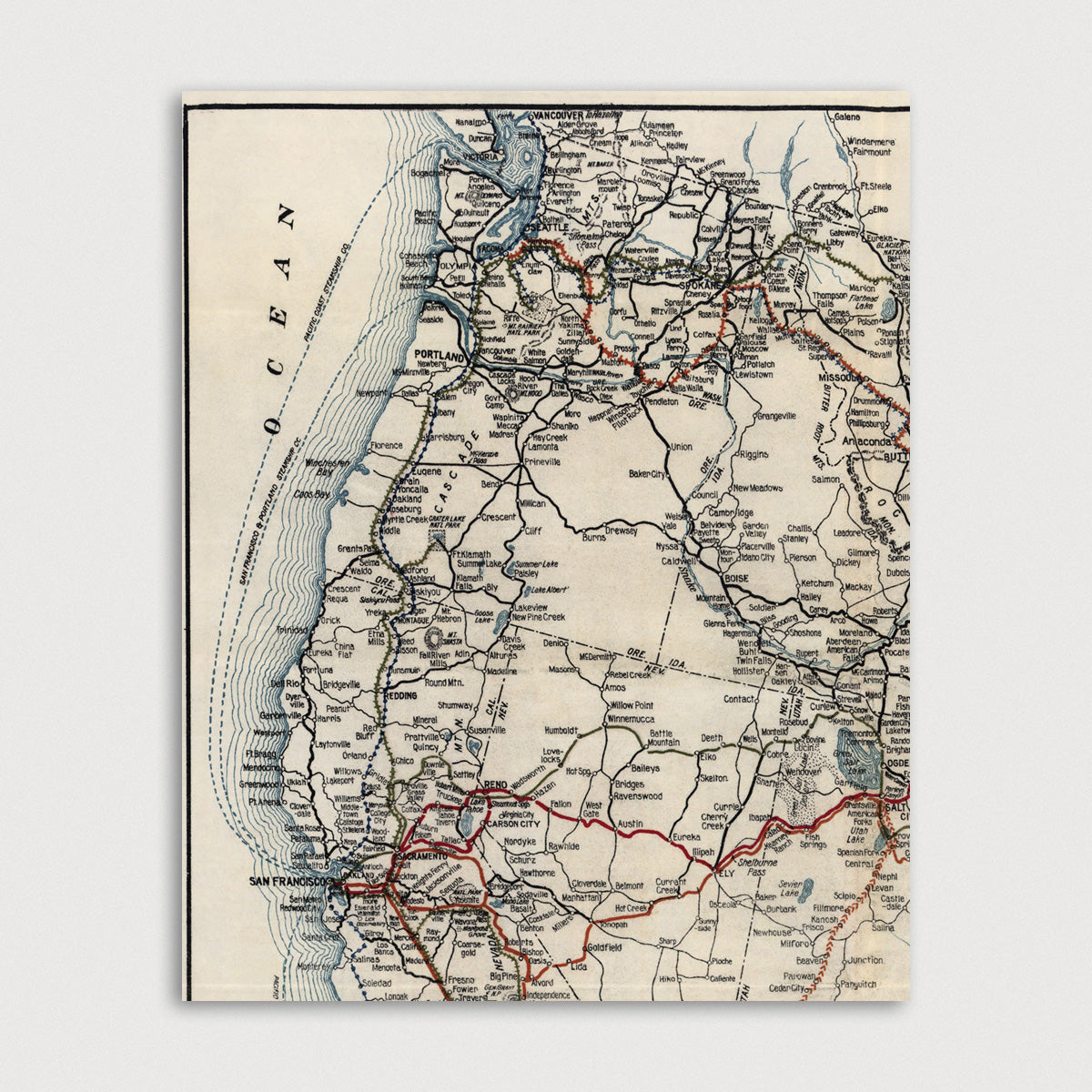
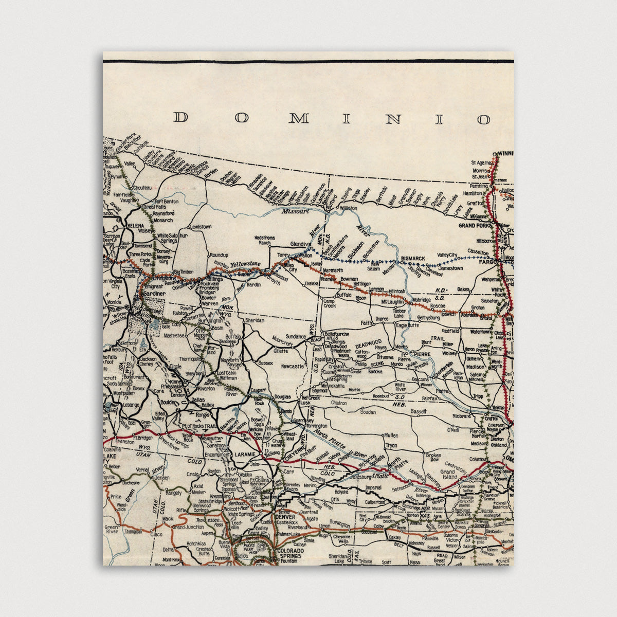
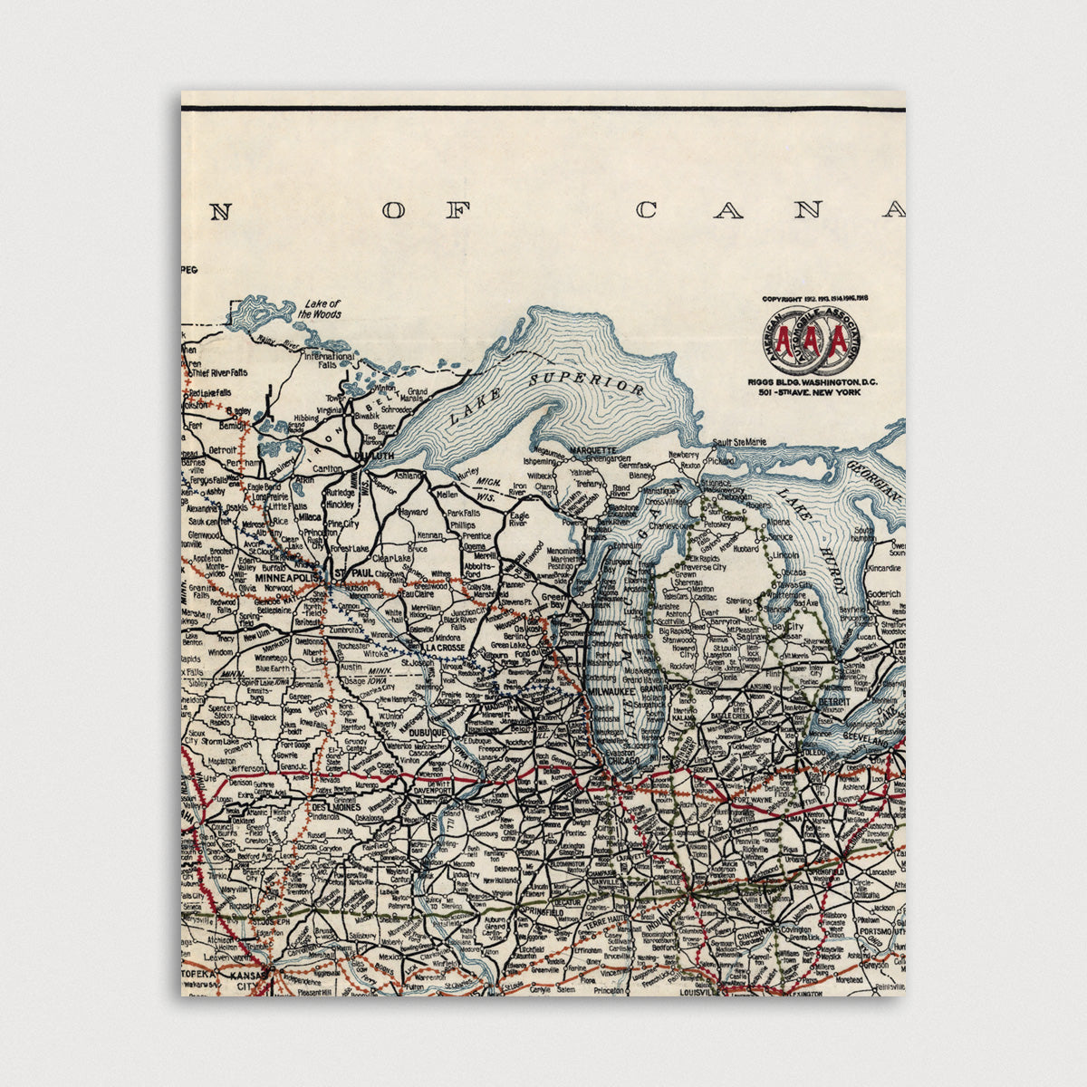
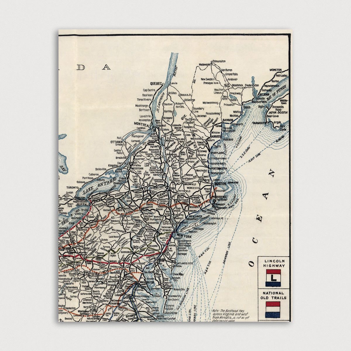
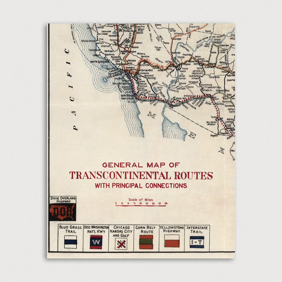
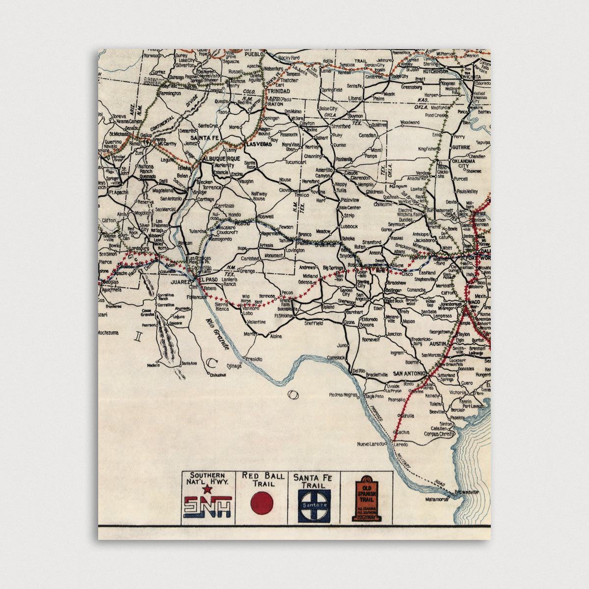
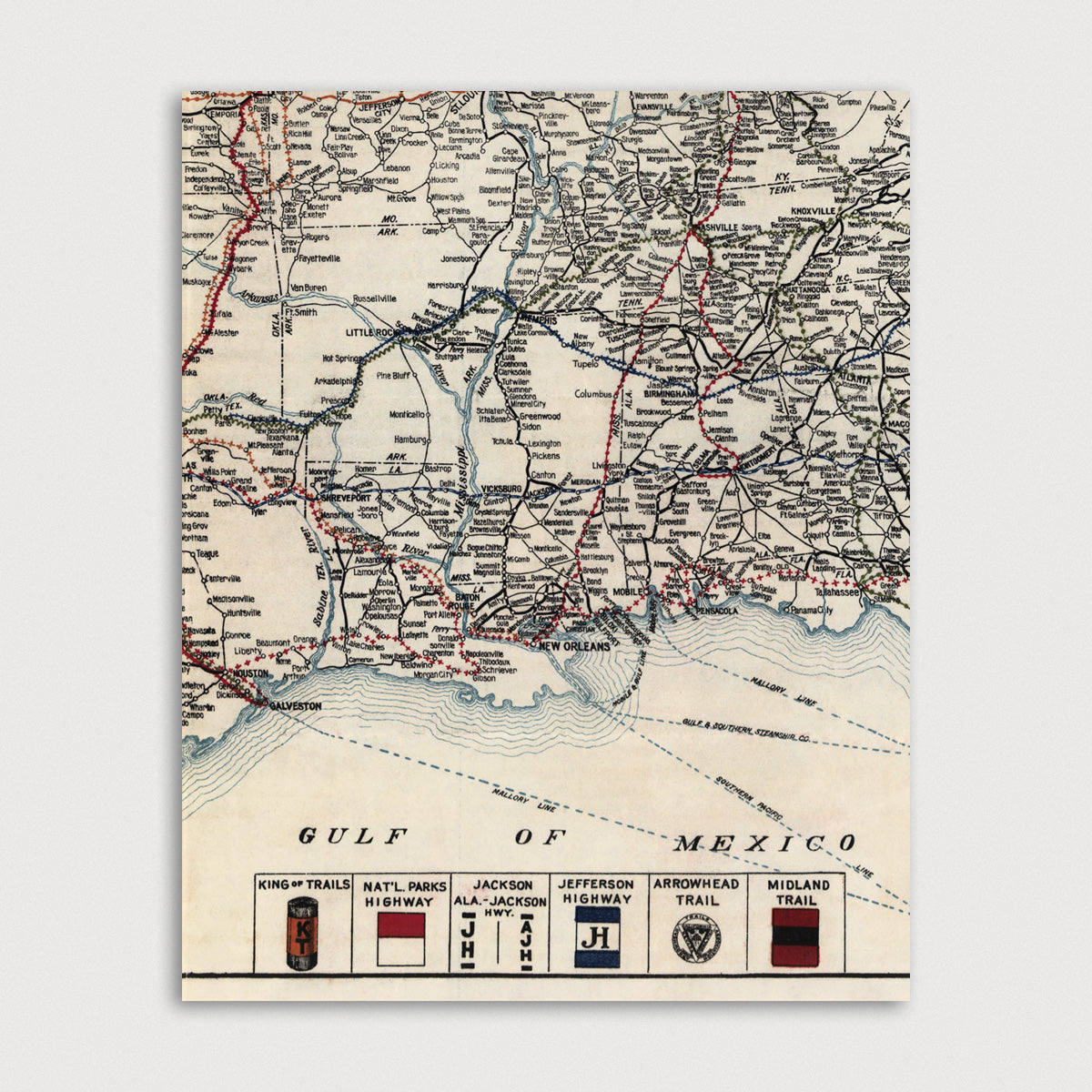
Archival print reproduction of an antique map of the United States from 1918 by the American Automobile Association.
- Medium: Archival pigment inkjet print
- Paper: 100% cotton, museum-quality, acid-free, heavyweight, matte finish
- Size: 8x10 or 11x14 inches per print
Sold as a set of 8 individual prints. Each print is sized to fit perfectly in a 8x10 or 11x14 inch frame without a mat.
All prints come unframed.
About This Map
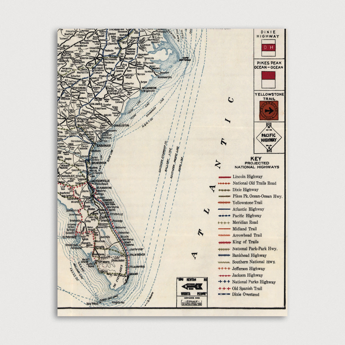
Road map of the United States showing the routes of named highways and trails. Each route is indicated by it's own symbol, and the route logos are shown along the bottom and right.
Routes include: Lincoln Highway, National Old Trails Road, Dixie Highway, Pikes Pk. Ocean-Ocean Hwy., Yellowstone Trail, Atlantic Highway, Pacific Highway, Meridian Road, Midland Trail, Arrowhead Trail, King of Trails, National Park-Park Hwy., Bankhead Highway, Southern National Hwy., Jefferson Highway, Jackson Highway, Old Spanish Trail, Dixie Overland.
Title: General Map of Transcontinental Routes with Principal Connections
Author: American Automobile Association
Year: 1918