


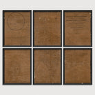
Washington, DC Antique Map Print Set (1876)
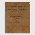
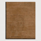
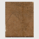
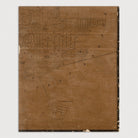
Archival print reproduction of an antique map of Washington, DC from 1876 by William Forsyth.
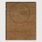
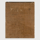
Detailed late 19th century map of Washington, DC showing numerous details, including streets, creeks, churches, schools (including Howard University and Georgetown "College"), markets, street car lines, and other places of interest. Shows the National Mall as it appeared at that time, with only the Washington Monument, Dept. of Agriculture, and original Smithsonian building. The city is shown as extending only north to mainly Florida Ave. (labeled as "Boundary Street") but includes the neighborhoods of Georgetown, Columbia Heights, Mount Pleasant, and part of Adams Morgan. The map also includes an inset of Alexandria in the lower left corner.
Product Details
Medium: Archival pigment inkjet print
Paper: 100% cotton, museum-quality, acid-free, heavyweight, matte finish
Size: 6 prints at 16x20 inches per print
Sold as a set of 6 individual prints. Each print is sized to fit perfectly in a 16x20 inch frame without a mat.
All prints come unframed.
Production Times & Shipping
We process and print all orders within 1–2 business days. Ground shipping is free within the US; ground shipping time is 1–5 business days. Shipping upgrades are also available. Read more about shipping.